Facts Matter:
While sea level rise resiliency planning in Hawaii is largely still based on no more than 3 feet of sea level rise, extensive research indicates that sea level rise may greatly exceed this threshold if global warming keeps increasing unchecked as it is now.
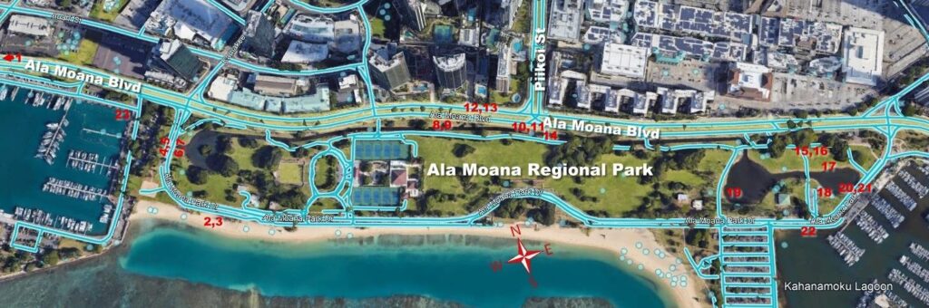
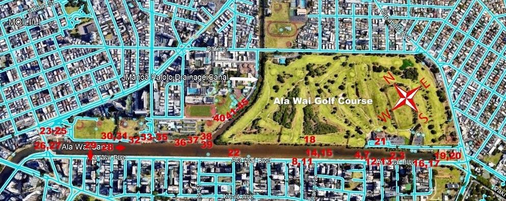
Because of the public’s disconnect between published science pertaining to continuing local sea level rise (SLR) and the ongoing permitting and construction in areas that are expected to be flooded/inundated in the not-too-distant future by a 3- to 4-foot sea level rise, we conducted photo-documented visual inspections from a lay person’s perspective during the Dec 4-6, 2021 and Jan. 2-4, 2022 King High tides. The Ala Moana storm drain canal in Kaka`ako and the Ala Wai Canal in Waikiki were chosen because they provide an around-the-clock visual evaluation of the movements of the tides to everyone. The photos well document what can be expected in the not-too-distant future in the areas where high rise construction is unabatedly continuing. The question is for whom?
Download or view the report (Dec. 2021):
Download or view the report (Jan. 2022):
Published site-specific research by local scientists indicated already that, at what they called a Minor Flood Threshold of 0.82 ft. (0.25m) and 1.73 ft. (0.52 m) by 2050 and 2100 (NOAA predictions 2030s, 2060s), infrastructure failure included 200 locations where drainage inlets lose all capacity for drainage and begin acting as conduits for flooding. This represents near doubling relative to the 2017 King Tide flooding. Such failures included all drainage inlets along Ala Moana Blvd. from Kewalo Harbor Basin to Kahanamoku Harbor basin, as visually documented by us (CMISLR) during the Dec 5, 2021 King High Tide and also the drainage inlets along Ala Wai Canal during the Jan. 4, 2022 King High Tide.
The much-publicized February 15, 2022 NOAA Interagency Sea Level Rise and Flood Hazard Report, updated after five years and based on emission of greenhouse gases to date that drive global warming, predicted only up to 12” sea level rise by 2050 and 24” by 2100 for low-lying Honolulu. However, the caveat, namely that the perhaps less than 12” sea level rise is based on today’s data of 1.1 degree Celsius (or 2 degree Fahrenheit) beyond pre-industrial levels is seldom pointed out when citing the report, as it also succinctly states Failing to curb future emissions could cause an additional 1.5 – 5 feet (0.5 – 1.5 meters) of rise for a total of 3.5 – 7 feet (1.1 – 2.1 meters) by the end of this century.
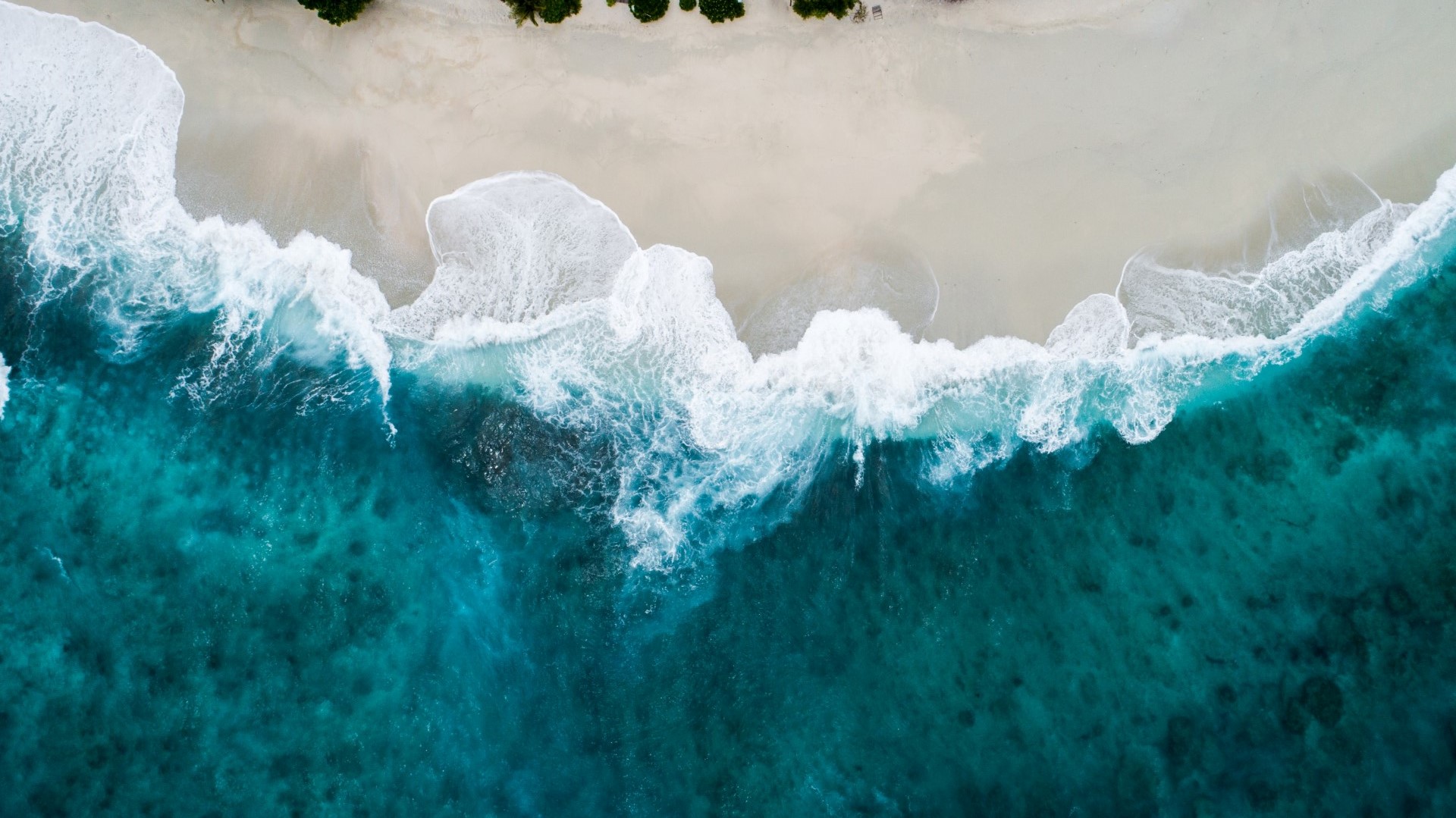
A 3-foot sea level rise, while heavily impacting Waikiki, would also greatly affect coastal Honolulu. With a 4-foot sea level rise, most of Waikiki as well as more than half of Kaka`ako would be under water. At a 6-foot sea level rise, much of Honolulu, Kaka`ako, Waikiki, and the shoreline extending easterly would largely cease to exist.
The dangers of climate change are mounting so rapidly that they could soon overwhelm the ability of both nature and humanity to adapt unless greenhouse gas emissions are quickly reduced, according to the most recent 2-28-2022 UN report on climate change. In 2019, storms, floods and other extreme weather events displaced already more than 13 million people across Asia and Africa. While global temperatures have increased already 1.1 degree Celsius (2 degree Fahrenheit) since the 19th century industrial revolution by burning coal, oil and gas for energy and cutting down forests, adaptation may be just an illusionary approach unless global warming can be stopped at 1.5 degree Celsius. It is feared that catastrophic, irreversible climate changes may be triggered past this point.
However, meeting this “line in the sand” would require countries to largely eliminate all fossil fuel emissions by 2050 which looks more unlikely day-by-day as the world is currently on a path of warming between 2 and 3 degree Celsius this century.
Needless to say, if we don’t do our best to greatly reduce our own carbon footprint, with the then expected sea level rise greatly exceeding four feet, Honolulu may cease to exist by 2100.
Water is the key to life. The Honolulu Board of Water Supply (BWS) has already experienced difficulty in repairing water main breaks along Ala Wai Boulevard, Ala Moana Boulevard, and Nimitz Highway, having to wait for low tide to complete pipe repairs. BWS anticipates that sea level rise w ill exacerbate water system maintenance and repair in the decades to come and adaptation measures in low lying and coastal areas need to be prioritized and implemented! What about other underground utilities such as sewer, electricity, etc.? Sea water intrusion into the underground storm drain system has already been documented at Beretania Street.
Infrastructure failure is presently already occurring during periods of high tides through storm-drain backflow (reverse gravity drainage flow through the underground municipal drainage system), traffic slowdowns along submerged roadways, and partial inundation of active cesspools exasperated through groundwater inundation (underground water table pushed to the surface). Almost 90% of the many cesspools still existing in Honolulu’s 4-foot sea-level-rise zone are already largely inundated during present-day King tide events (sea level rise in excess of 1.15 feet or 0.35 meters) and even bi-monthly new and full moon high tides. Know where and when to swim.
As already stated above, with just 1.73-ft. (0.52-meter) sea level rise, 200 drainage inlets will lose all capacity for drainage and begin acting as conduits for flooding (doubling the damage relative to the 2017 flood cycle). At 2.7-ft. (0.82-meter) sea level rise, more than 800 drainage inlets are expected to fail. By the mid-2030s, Honolulu is expected to experience its first year with more than fifty high-tide floods (nuisance or sunny day floods above 1.15 feet or 0.35 meters sea level rise) when the moon’s monthly new and full moon cycles will amplify rising sea levels caused by climate change.
While some coastal erosion could be contained by seawalls, they cannot stop flooding because of groundwater inundation during sea level rise and high tides that lift Oahu’s caprock aquifer to the surface, which consists of brackish and polluted water that floats on a base of higher-density saltwater connected to the ocean. Such polluted water will slowly turn into wetlands which will require costly engineering, where feasible, for municipalities to continue to function.
While sea level rise resiliency has been a buzz word often used to sidestep the realities of sea level rise, Dr. Fletcher, UH interim dean of Ocean and Earth Science Technology, summarized the possible future of Waikiki more succinctly in a February 18, 2022 KHON interview as such: “Is it feasible to raise the land in Waikiki and redesign the buildings on raised land? Is it feasible to raise the buildings and not raise the land? Is it feasible to move out of Waikiki and somehow deconstruct Waikiki and leave it in the form of the wetland that it originally was over 100 years ago?“
The Hawaii Department of Transportation also estimates that it will cost over $15 billion alone to raise the estimated 20% of highways before 2100 (and hopefully within the next fifty years) that are most vulnerable to sea level rise. However, planning for just a 2- to 3-foot sea level rise may be a waste of money as we must plan for at least a four-foot sea level rise.
Given these facts, ask every elected official why and for whom are we still developing and also still building high rises in the 4-foot sea-level-rise zone? Surely not for the working people that have been priced out of homeownership for quite a while and are still searching for elusive truly affordable rental housing that actually does not exist in Hawaii. Off-the-grid living on the Big Island is not an affordable housing solution. An island-by-island comprehensive planning approach is therefore needed to not only meaningfully tackle sea level rise but also the affordable housing crisis.